
FILES AVAILABLE FOR DOWNLOAD:
- AutoCAD (DWG).
- MicroStation (DGN).
- Adobe Acrobat (PDF).
- Bitmap Image (JPG).
Visit i-avanzada and browse more Geolocated Layouts.
KEY FEATURES:
- Developments and methodologies: Based on information available from Earth orbit.
- Geolocated High Resolution Satellite Orthomosaics: TIF file.
- Reference coordinate system country:
- 🇨🇴 MAGNA-SIRGAS / Zona Bogotá – Colombia / EPSG 3116.
- Units: Meters [m].
- Paper size: DIN A1 (841x594mm).
- Print scale: 1=1.
- Updatable over the time.
- AI vector process analysis ready.
- Available scales: 1=20000, 1=10000, 1=5000, 1=2500 and 1=1250.
- Orthomosaics: Ready for large format printing.
APPLICATION:
- Facilities Management.
- Layout Optimization.
- Engineering / Procurement / Construction (E/P/C).
- As-Built Designs.
SECTOR:
- Urban Planning.
- Manufacturing.
- Infrastructure Projects.
- Sustainable Energy.
- Conventional Energy, Gas and Oil.
- Real Estate.
PRICE:
- AutoCAD (DWG): From US$99.
- MicroStation (DGN): From US$99.
- Adobe Acrobat (PDF): From US$39.
- Bitmap Image (JPG): From US$19.
| CODE | PROJECT | COUNTRY | IMAGE |
|---|---|---|---|
| 1086GL | Concordia – Antioquia | Colombia | 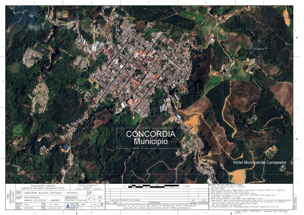 |
| 1087GL | Malecón 72 | Colombia |  |
| 1088GL | ENERFÍN – Parque Solar Portón Del Sol | Colombia | 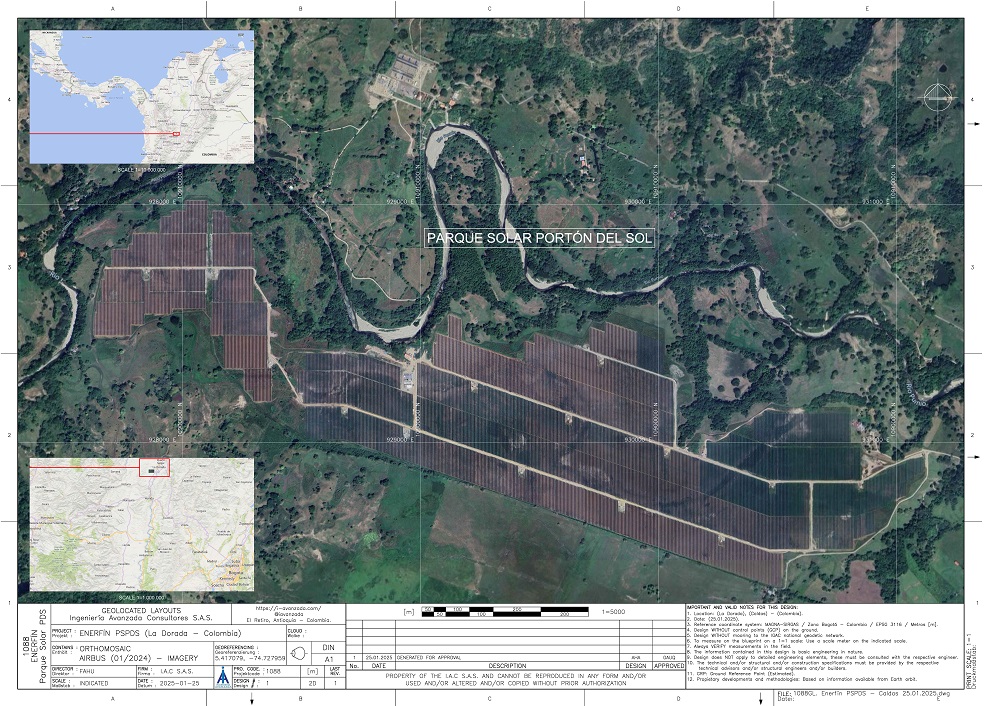 |
| 1089GL | Punta Canoas Real Estate Asset – Bolívar | Colombia |  |
| 1068GL | Lote Reservado – El Retiro (Antioquia) | Colombia | 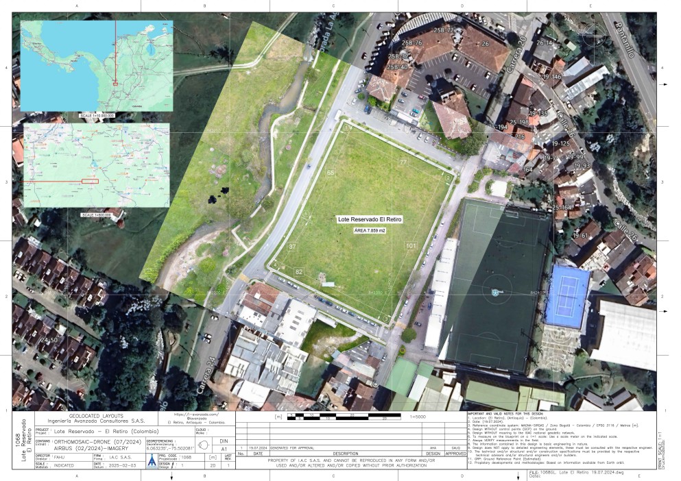 |
| 1090GL | Cauca Viejo – Jardín (Antioquia) | Colombia |  |
| 1091GL | Tecnoglass – Barranquilla (Atlántico) | Colombia |  |
CONTACT US / CONTÁCTANOS HERE
BUY HERE

