
Precision 3D-VR Assets: High-Fidelity Reality Capture & Digital Reconstructions
Accelerate your workflow with our exclusive library of high-resolution 3D digital reconstructions. Captured via professional drone missions and satellite aerophotogrammetry, each asset provides a unique, field-verified representation of critical infrastructure, natural landmarks, and urban developments.
Our assets are more than just models; they are precise polygon meshes with high-resolution textures, optimized for GIS integration, environmental simulation, and immersive VR/AR experiences. From the vertical drops of Tequendama Falls to the complex engineering of Hidroituango, our data is built for professionals who demand real-world accuracy.
Technical Dominance:
- Multi-Industry Application: Infrastructure, Topography, Real Estate, and Natural Resources.
- Universal Compatibility: Available in 12 professional formats for seamless integration into AutoCAD, Unity, Unreal Engine, and GIS software.
- Ready to Deploy: Fully textured meshes designed for high-end visualization and technical analysis.
Available Formats:
FBX, OBJ, GLTF/GLB, 3DS, DAE, WRL, ABC, PLY, DXF, STL, PDF, and JPG.
| CODE | NAME | PRICE | IMAGE |
| 150 | SALTO TEQUENDAMA – TEQUENDAMA FALLS | US$39 | 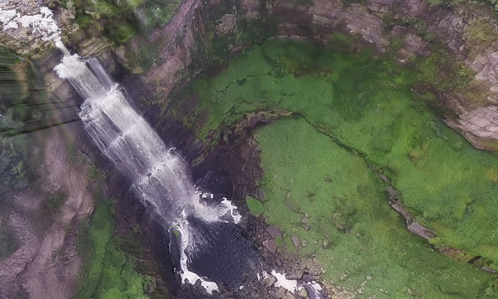 |
| 154 | SIERRA NEVADA DE SANTA MARTA 3D MODEL | US$29 |  |
| 163 | VOLCAN NEVADO DEL RUIZ – NEVADO DEL RUIZ VOLCANO 3D MODEL | US$21 |  |
| 165 | Villa Hortensia Farm RGB – 2a | US$39 | 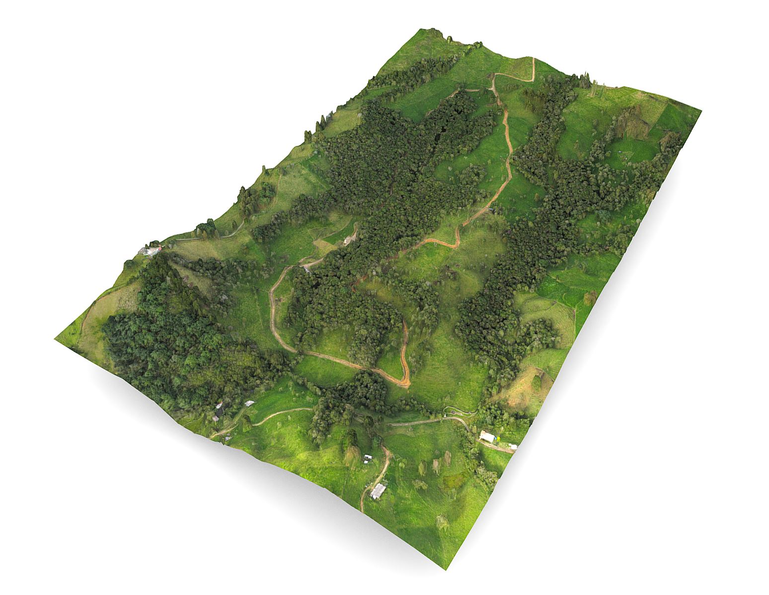 |
| 190 | HIDROITUANGO HYDROELECTRIC POWER PLANT 10 11 2018 3D MODEL | US$27 | 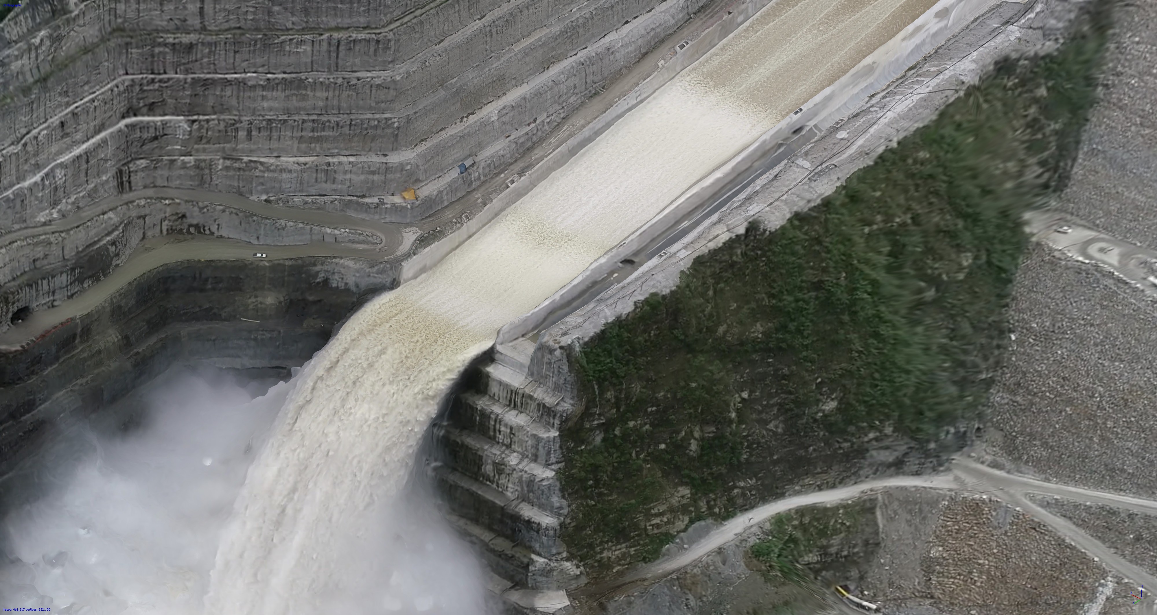 |
| 280 | Salto Angel – Angel falls – Kerepakupai Vena 1 | US$29 | 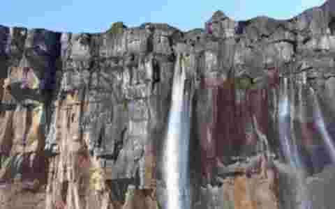 |
| 550 | CASCADA SALTO DEL BUEY – BUEY FALLS | US$39 | 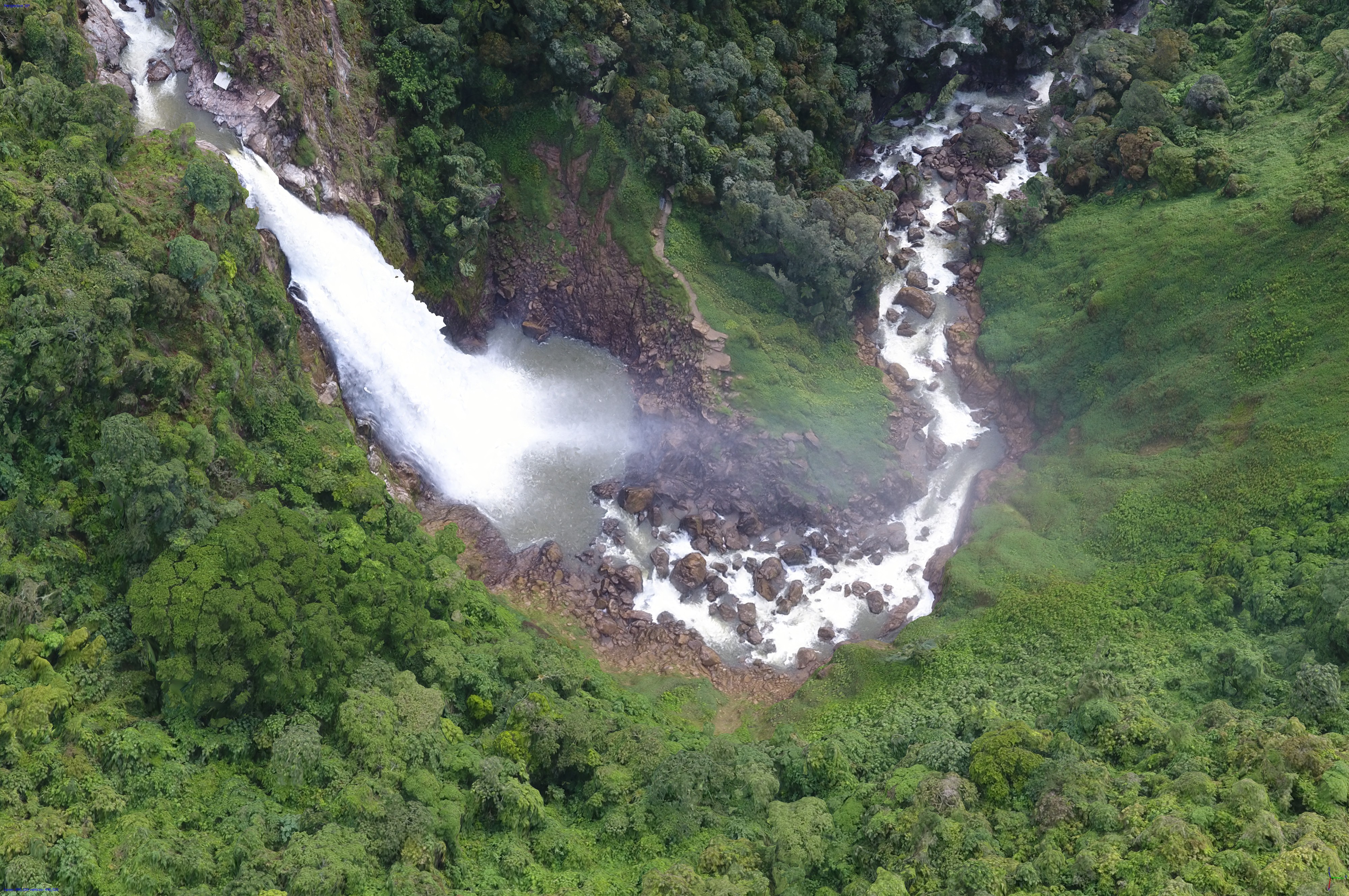 |
| 1071 | EL AGORA – LOTES CAMPESTRES URBANIZADOS 3D MODEL | US$29 | 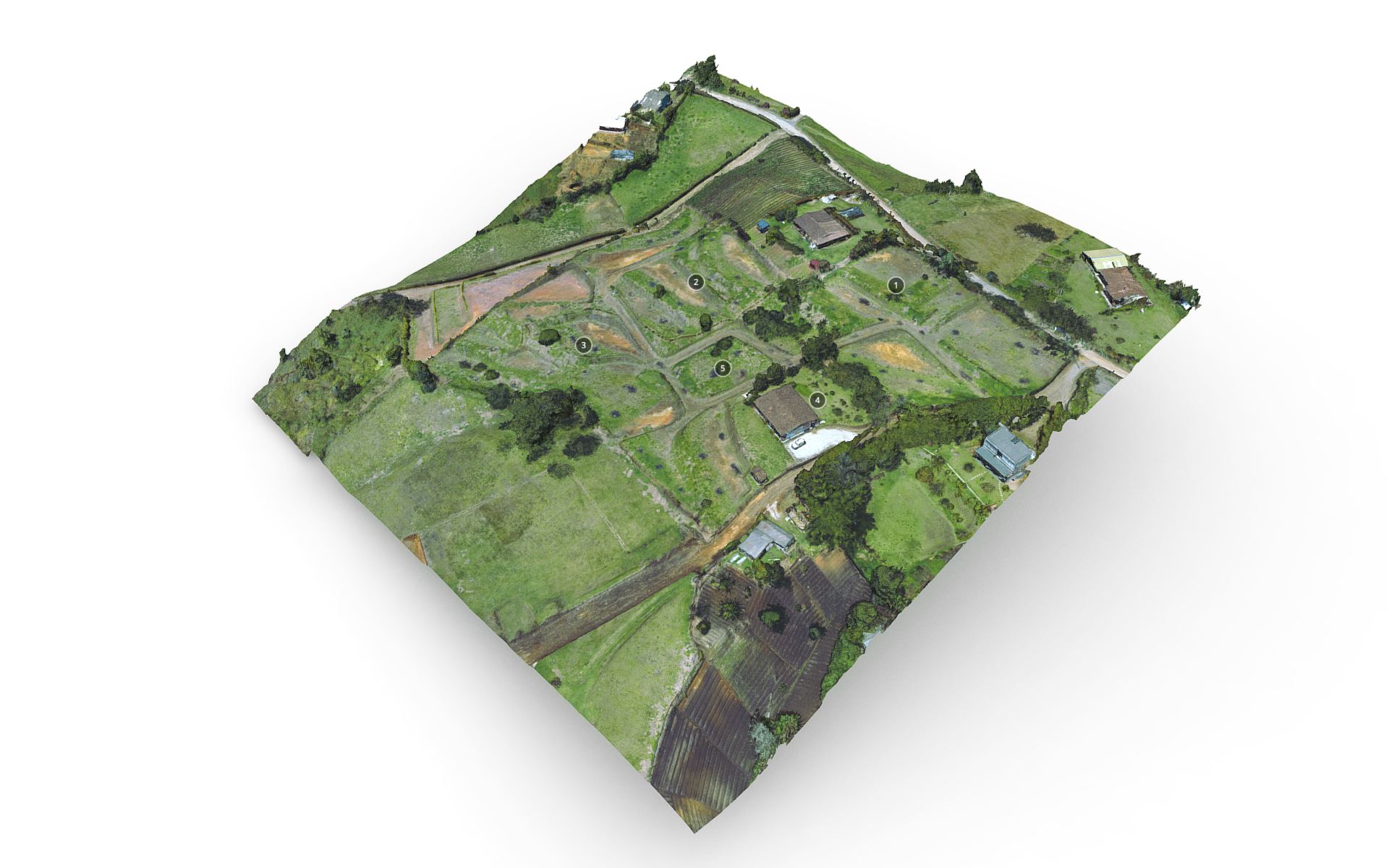 |
| 1074 | PUERTO MOCHO 3D MODEL | US$29 | 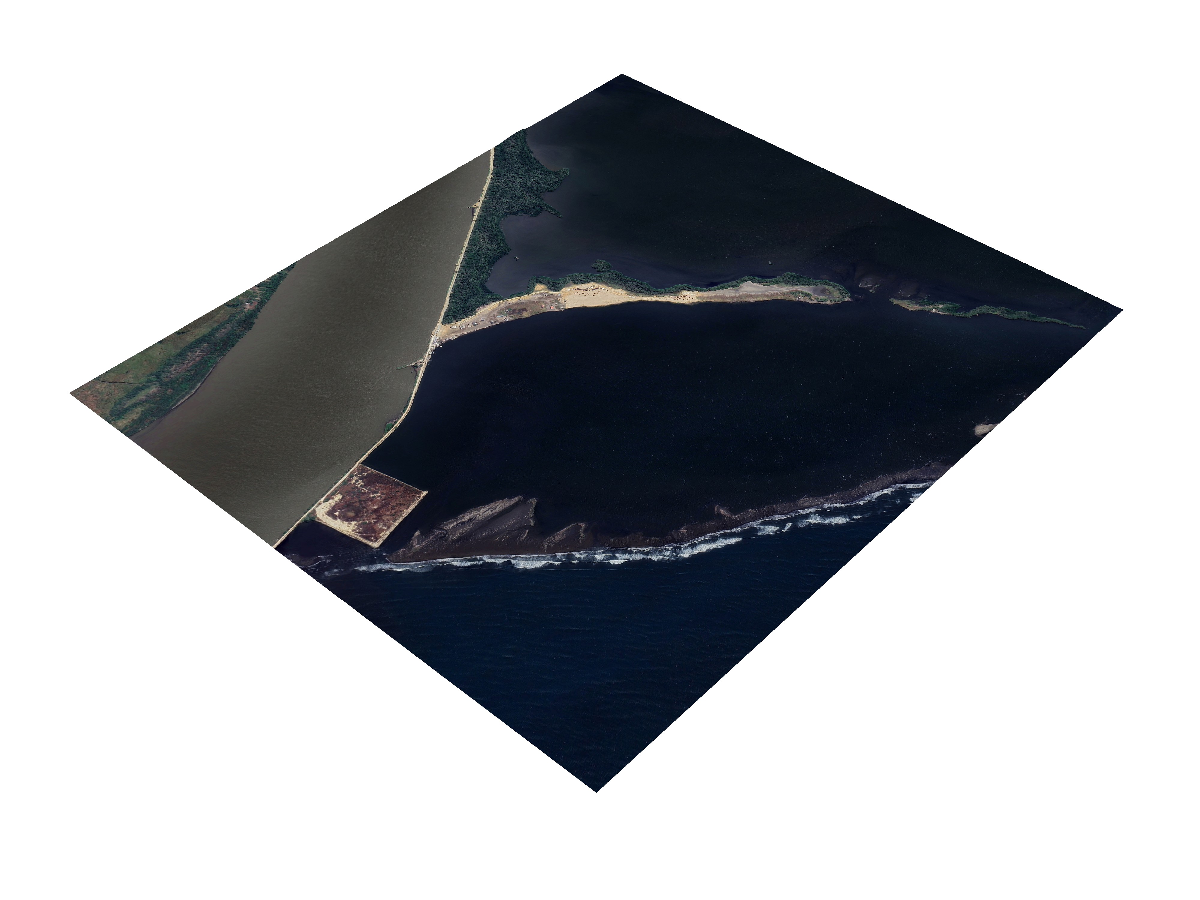 |
| 1075 | BOCAS DE CENIZA 3D MODEL | US$29 | 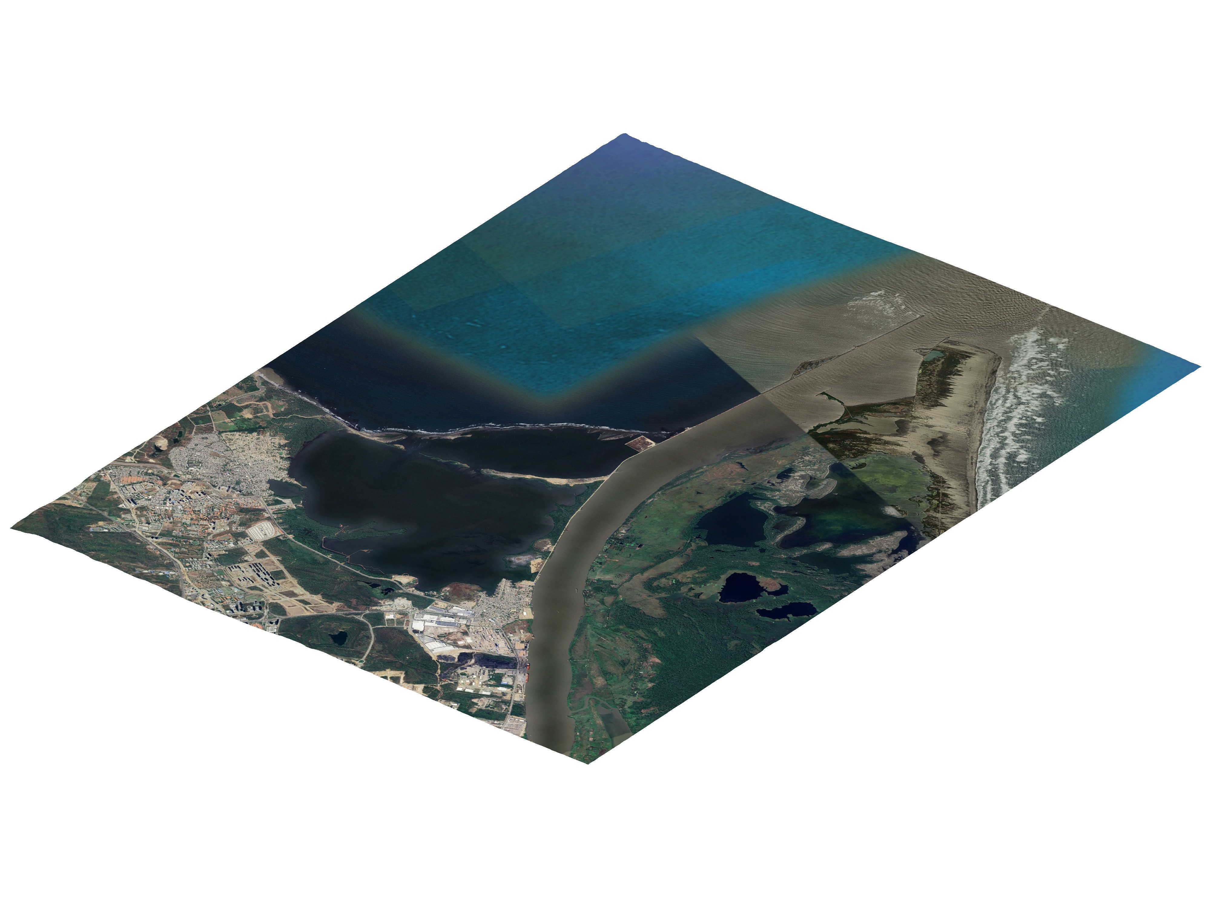 |
CONTACT US / CONTÁCTANOS HERE
BUY HERE

Technical Keywords: Reality_Capture_Data, Drone_Photogrammetry_Scan, Satellite_3D_Reconstruction, GIS_Ready_Assets, Digital_Twin_Infrastructure, High_Resolution_Terrain_Mesh, Precision_Geodata_Model, Industrial_VR_Simulation, Topographical_Digital_Scan, Colombian_Landmark_3D, Infrastructure_Visualization, BIM_Compatible_Models, Environmental_Data_Capture, Reality_Modelling_Service, Technical_Mesh_Geometry, Point_Cloud_Derived_Models, Urban_Development_3D, Professional_Field_Mapping
